
Walk a Channelview Street Record Trail
A street-by-street search in Channelview begins with the appraisal record because Channelview is an unincorporated Harris County community, not a city with its own property office. HCAD can connect a site address to an account number, property or situs address, owner and mailing field, legal description, map facet, key map, tax year, and jurisdiction fields. Those fields describe a parcel and its appraisal record. They do not establish a full current household. The Harris County Clerk supplies the recorded-instrument route, while a dated directory or an individual voter-status check may add a narrower, time-specific lead.
Keep the entered address beside the normalized street name, number or unit, ZIP, postal city, HCAD account, legal description, source date, and a confidence label. That small record trail matters locally because a postal label can say Channelview or Houston, and an HCAD site number can be zero or use a different street convention. It also prevents a same-street match from being mistaken for an exact parcel match.
- Enter the address in HCAD Quick Search and save the account, situs, legal description, map facet, and key map from the matching record.
- If the exact entry fails, use HCAD’s range-address option, similar-street option, and the same-street values link when it appears.
- Open the HCAD Parcel Viewer for approximate map context, then click the selected parcel rather than assuming a pin is the record.
- Use the legal description or current owner in Harris County Clerk Real Property Search to find recorded instruments and prior transaction parties.
- For a person already identified, use the Harris County voter search only as its individual current or pending-status tool permits, then label a historical directory entry with its year.
Note: An exact parcel match is stronger than a street-name match, but neither one proves current occupancy by every person connected with an address.
Channelview Address Search Starts at HCAD
HCAD’s quick search is the practical first stop for a Channelview street search. It offers account, address, range-address, and owner-name paths. An owner query uses a last name and first initial without a comma. Address searching accepts a street number and name, with a similar-street option when the wording is approximate. HCAD help cautions that this is not a map-engine geocoder. A property may have an alternate street spelling, a separate mailing address, a zero site number, or no mapped account, so a no-result needs more than one follow-up.
The official HCAD Quick Search shows the account, address, range, and owner tabs used to start that work.
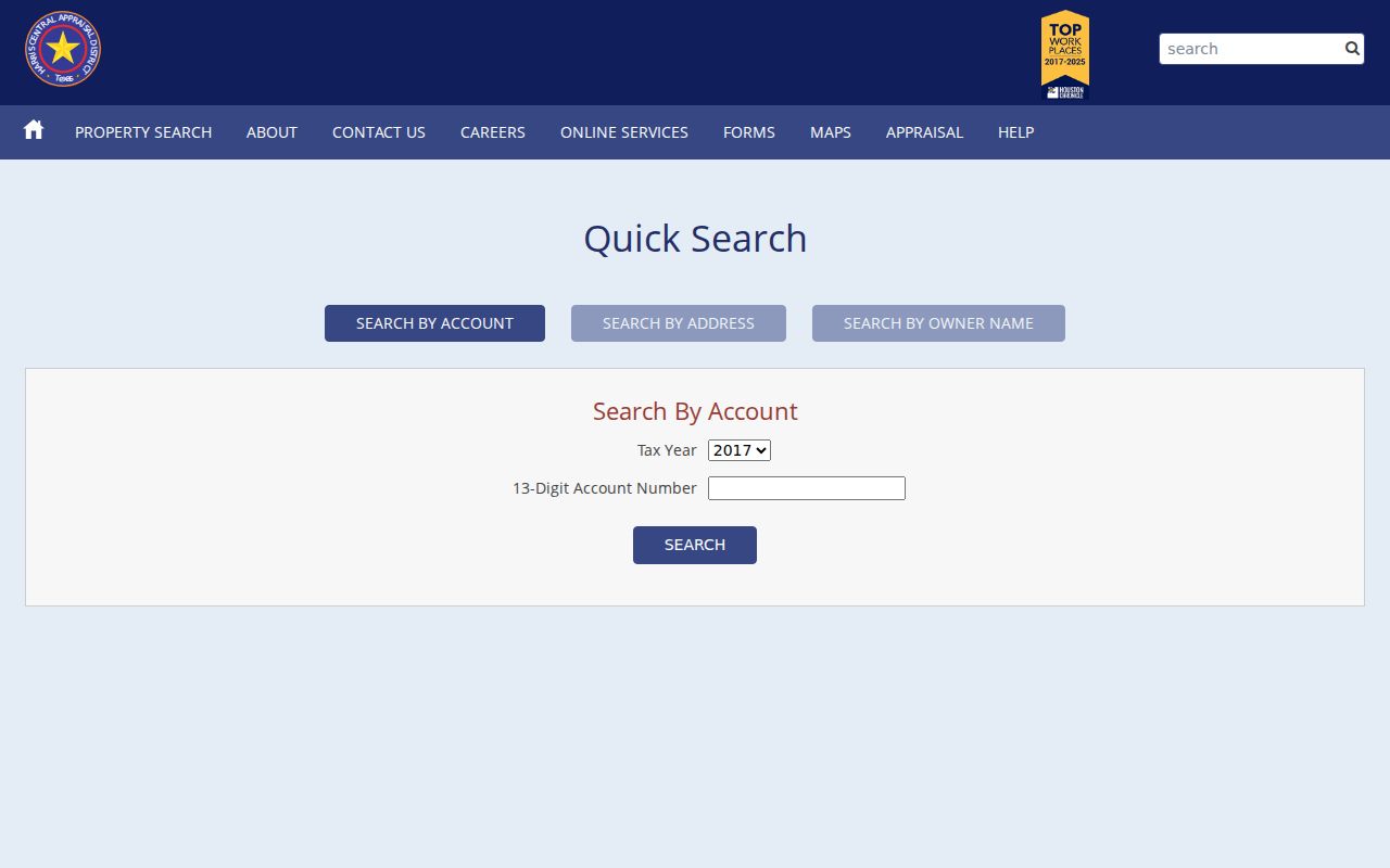
Use the result as a parcel bridge, then preserve both the property address and the owner mailing field as separate labels in a research note.
HCAD’s public detail can show exemptions, taxing jurisdictions, values, land and building details, neighborhood, map facet, and key map in addition to the core address fields. It does not display residential photos, sketches, floor plans, or age information under the Texas restrictions reported by HCAD. The public download page also lists property data years from 2005 through 2026, but the tax year and preliminary or final status should always travel with a value citation.
Channelview Address Fields That Narrow a Street
When the street name alone produces too many possibilities, HCAD Advanced Search lets a Channelview address search combine street text with beginning and ending numbers, ZIP, legal description, key map, map facet, school district, codes, value, and size filters. Partial prefix matching can work. Legal-description and map-reference fields are often steadier than a street string when the road text is incomplete. Required status was not shown on the inspected form, so the field map reports it as not stated.
The HCAD Advanced Search is the source for the ZIP, legal-description, map, code, value, and size filters shown here.
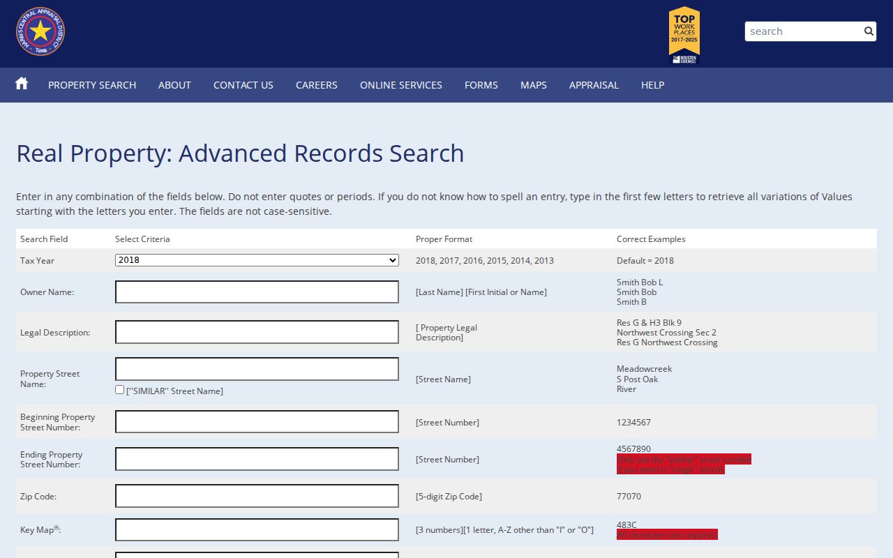
Combining a ZIP with street and legal-description details narrows appraisal accounts, not a complete list of people or addresses in that postal area.
| HCAD control | Entry type | Required | Useful Channelview use |
|---|---|---|---|
| 13-digit account number | Text | Not stated | Direct parcel bridge, entered without hyphens. |
| Street number and name | Text | Not stated | Use similar-street matching when formatting differs. |
| Range from and to | Text pair | Not stated | Reviews a segment of one named street. |
| ZIP code | Text | Not stated | Narrows advanced appraisal results by postal area. |
| Legal description | Text | Not stated | Bridges a parcel to deed and plat records. |
| Key map or map facet | Text | Not stated | Preserves a map reference when street text is inconsistent. |
Note: HCAD makes map facet and key map useful continuity fields, but the parcel viewer itself warns that its boundaries are approximate and not a survey.
Channelview's Zero-Numbered Address Clue
One official Channelview appraisal example illustrates why an exact-looking address can still need broader address research. The HCAD material reproduced in a Texas Comptroller document identifies an industrial parcel as 0 Wallisville Rd, Channelview, TX 77049, with account 0480680000005, legal description TR 1A ABST 1530 A PETERSON, map facet 6060A, and key map 458R. It is property context, not a residential example. Its value is procedural: save the account and legal description before assuming a road-number search has failed.
Wallisville Road also appears in the local planning-study geography and at the North Channel Library. Those place clues can occur with a Houston postal presentation even though the relevant record trail is in unincorporated Harris County. The right response is to retain each source’s label, not force it into a city boundary that does not exist for Channelview.
Channelview Recorded Deeds Use Legal Descriptions
The County Clerk’s real-property index is the transaction layer of a Channelview street search. It can be searched by file number, film code, recording-date range, grantor, grantee, trustee, subdivision or description, instrument type, volume or page, and lot, block, tract, abstract, reserve, or outlot. A file number is the most direct lookup when known. Name entries use last name first without punctuation, and partial-name searching generally needs at least three characters. When a road address is ambiguous, use subdivision, lot and block or tract and abstract instead.
The Harris County Clerk’s deed index exposes the grantor, grantee, legal-description, date, file, film, and instrument controls used for that bridge.
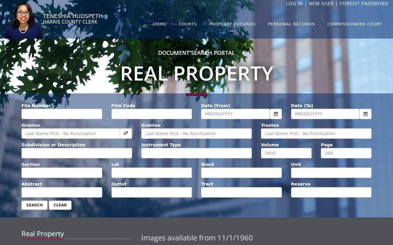
Record the file number, recording date, document type, parties, and legal description before opening an image, because they remain the durable citation fields.
Online images and index information begin November 1, 1960, and a newly recorded document may take one to two business days to appear. The online database is not the official repository, and some information is redacted. For a certified copy, earlier books, or a question about the current fee schedule, use the Clerk’s real-property information page and its counter, mail, or copy process. TSLAC microfilm and the Clerk or archives route remain the fallback for older material.
Channelview Street Records Compared
Different address-indexed sources answer different questions. An appraisal record can identify the parcel and listed owner or mailing contact. A deed index documents a recorded transaction. A permit can show address-linked development activity where public. A directory is a dated historical snapshot. The individual voter route has regulated fields and is not a browser for everyone on a street. Keeping those distinctions in the record trail makes the result easier to check later.
| Address-keyed source | Custodian | What it can show | Channelview access route |
|---|---|---|---|
| Appraisal parcel card | HCAD | Account, owner or mailing field, situs, legal description, values, and jurisdictions | Current web record; 1895-1997 Archives, 1998-2008 HCAD contact, 2009-current online |
| Parcel map | HCAD GIS | Approximate parcel geometry and map context | Online viewer, with an approximate-boundary warning |
| Recorded instrument index | Harris County Clerk | Parties, instrument, recording date, legal description, file or film data | Online images from 1960-11-01; older series through Clerk or TSLAC |
| Permit or project record | Harris County OCE | Public development or project details by address or project number | County portal or request; historical field coverage was not located |
| Regional directory | Library and archive collections | Dated occupant, subscriber, business, or address clue | Historical page-image research, including regional 1967 and 1970 examples |
Property records from 1895 through 1997 are routed to Harris County Archives, records from 1998 through 2008 require an HCAD contact route, and 2009-current is the strongest online appraisal period. That three-part handoff is more reliable than treating an online result as a complete property history.
- Parcel
- A tract of land represented by an HCAD account and linked to property, tax, and map fields.
- Situs address
- The property’s physical address field. It is different from an owner’s mailing address.
- Plat
- A recorded map that identifies a subdivision, lot, block, or related land layout.
- Criss-cross directory
- A historical reverse directory that begins with an address and gives a dated occupant or subscriber clue.
Channelview Street Permits Stay County-Run
There is no Channelview city building department because the community is unincorporated. For address and development context, the county route is the Harris County Office of the County Engineer. Its public guidance points to address information, floodplain checks, project numbers, ESID checks, and development-permit services. A project or permit can help date visible work or identify the next county record to request, but the research did not locate a complete public historical permit index or a fixed set of result fields.
The OCE permit FAQ shows the county’s address, project, floodplain, and service questions.
Use the project address or number when available, then ask OCE for an existing project file, log, or retention series rather than requesting a new list of people.
For service issues in unincorporated territory, Harris County 311 is also address-keyed. OCE’s civil permits page provides the related county service route. Neither source turns permit information into a current-resident list.
Channelview Street Labels Can Say Houston
Channelview street research must keep postal presentation separate from jurisdiction. ZIP 77530 is directly confirmed by the Channelview Post Office, while official Channelview-area records also use 77049 with a Houston postal label. The City of Houston’s 77049 map includes a Channelview label, a ZIP boundary, and a city-limit line. It demonstrates the overlap without converting Channelview into an incorporated city or making a postal city into a records custodian.
Check an address with the official USPS Channelview Post Office listing before treating a postal label as final. Pair that with HCAD’s situs and legal description when a property search needs geographic context. The 77049 ZIP map is a useful boundary illustration, but an exact CDP-to-ZIP polygon crosswalk was not located in the official sources.
Note: A Channelview or Houston postal city is a delivery label, while HCAD, OCE, and the County Clerk identify different parcel and custodial geography.
Historical Channelview Street Snapshots
Regional directories can add an older address clue after the parcel and deed trail are documented. The 1967 Baytown-area directory and its 1970 supplement include Channelview business coverage, but they are not a complete standalone local directory. Read a page image with its year, publisher, page, abbreviations, and OCR quality. A repeated listing may strengthen historical context, yet it still does not establish a present connection to the address.
The digitized 1967 regional directory page is an example of this limited local coverage. For older deed, probate, tax, or naturalization series, the Texas State Library and Archives Commission Harris County microfilm guide is the appropriate fallback. Channelview’s post office dates to 1933, so still earlier records may be indexed under nearby road, river, precinct, school, refinery, or county descriptions.
Channelview Street Results Need Labels
Use a plain confidence label beside every Channelview street result: exact parcel, same-street candidate, postal-only, historical directory, or unverified. An exact parcel means the address, HCAD account, and property context agree. A same-street candidate means the result sits on the named road but still needs account or legal-description confirmation. Postal-only means the delivery label fits but the parcel has not been confirmed. Historical-directory means the source itself is dated and limited. Unverified is the honest result when the chain has a gap.
This approach is especially useful for a legal description that persists while a street format changes. It also prevents a deed party, an owner mailing contact, or a directory entry from becoming a claim about every person associated with the property. If the search shifts from an address trail to verifying one named person, the Channelview resident lookup uses a different, person-focused record path.
Limits of a Channelview Street Directory
Address records have firm boundaries. HCAD lists appraisal and ownership-related fields, not a complete occupancy roster. County Clerk instruments document recorded legal transactions, not all people who have lived at a parcel. The public voter tool is an individual registration-status route, and protected or confidential fields are restricted under Texas law. Private utility, delivery, and motor-vehicle information are not a general street-search source. A missing result can reflect spelling, timing, retention, redaction, or a record held through another channel.
Texas Public Information Act requests may seek an existing index, log, image series, or retention schedule from the right custodian. Under Texas Government Code Chapter 552, ask for the identified record series and date range, not a newly compiled list of everyone associated with a street.