
Channelview ZIP Codes in Record Geography
Only two ZIP presentations are directly supported by the official sources reviewed for Channelview. ZIP 77530 is anchored by the Channelview Post Office. ZIP 77049 also appears in official Channelview-area records, even though its postal city is Houston. This is an important distinction for local ZIP research: a ZIP is a postal routing label, while HCAD, the County Clerk, and county departments use parcel, legal-description, and jurisdiction fields for their work.
| ZIP | Areas Covered | Post Office | Notes |
|---|---|---|---|
| 77530 | Primary Channelview post-office area and central community or civic addresses | Channelview Post Office | Use USPS to validate each exact delivery address. |
| 77049 | North Channel and Wallisville-facing Channelview-area records | Houston postal presentation | Official map and HCAD examples connect it with Channelview-area geography. |
An exact CDP-to-ZIP polygon crosswalk was not located in the official research. Other ZIPs should not be added as Channelview coverage without an official address-level confirmation. That restraint makes a search result clearer than a broad list based only on a nearby map.
Note: Postal labels help route mail, while a parcel record and legal description identify the property record that an address search can actually verify.
Channelview ZIP Code 77530 Has a USPS Anchor
The Channelview Post Office is the direct official anchor for 77530. USPS lists it at 531 Sheldon Road, Channelview, TX 77530-9998, with the facility phone number and hours on the live listing. Those details can change, so use the official address lookup or facility page when a mailing label must be checked. A confirmed postal ZIP helps begin an HCAD search, but the property’s situs, account, and legal description remain separate fields with their own record purpose.
The USPS Channelview Post Office listing provides the verified 77530 facility detail used for this local postal reference.
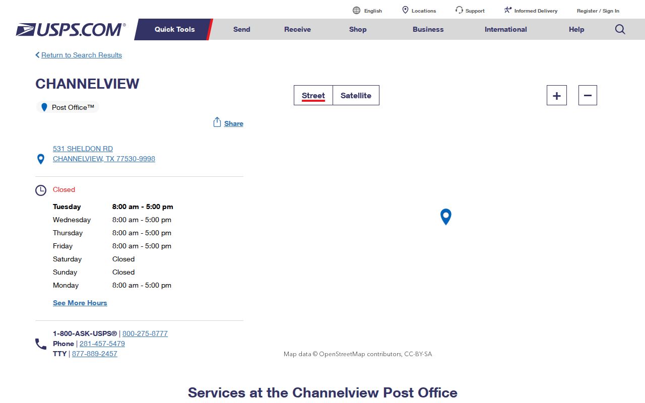
Use this postal source to check a delivery presentation, then retain the input address exactly as entered before comparing it with the county parcel record.
USPS is the postal authority. Harris County OCE is the relevant development and address authority for this unincorporated community, while HCAD is the practical appraisal-account bridge. A postal result alone should therefore not be used to decide whether an address falls in a particular municipal jurisdiction.
Channelview ZIP Code 77049 Can Say Houston
ZIP 77049 is the most useful local mismatch to understand before running a ZIP code search. The City of Houston’s 77049 map shows the ZIP boundary, a city-limit line, Channelview labels, Channelview Golf Course, and the San Jacinto River. Separately, an official HCAD sample uses 0 Wallisville Rd, Channelview, TX 77049. North Channel Library is listed at 15741 Wallisville Road, Houston, TX 77049. These official examples show why postal city, CDP or planning geography, and property jurisdiction must remain separate labels.
The City of Houston 77049 ZIP map is the boundary illustration. The North Channel Library listing is a second official local example of the Houston postal presentation. Neither means all 77049 addresses are within a single city or that every Channelview-area record uses the same postal city.
Channelview ZIP Code Filters in HCAD
HCAD Advanced Search is the official property-record tool that accepts a ZIP Code filter. It can be combined with owner name, legal description, property street name, beginning and ending street number, key map, map facet, school district, state category, building style, land code, neighborhood number, total value, and total living area. The resulting list is a set of matching appraisal accounts. It is not a complete census of people, addresses, or current occupants in a ZIP.
The HCAD Advanced Search displays the ZIP, legal-description, map, code, value, and size controls used to narrow an appraisal query.
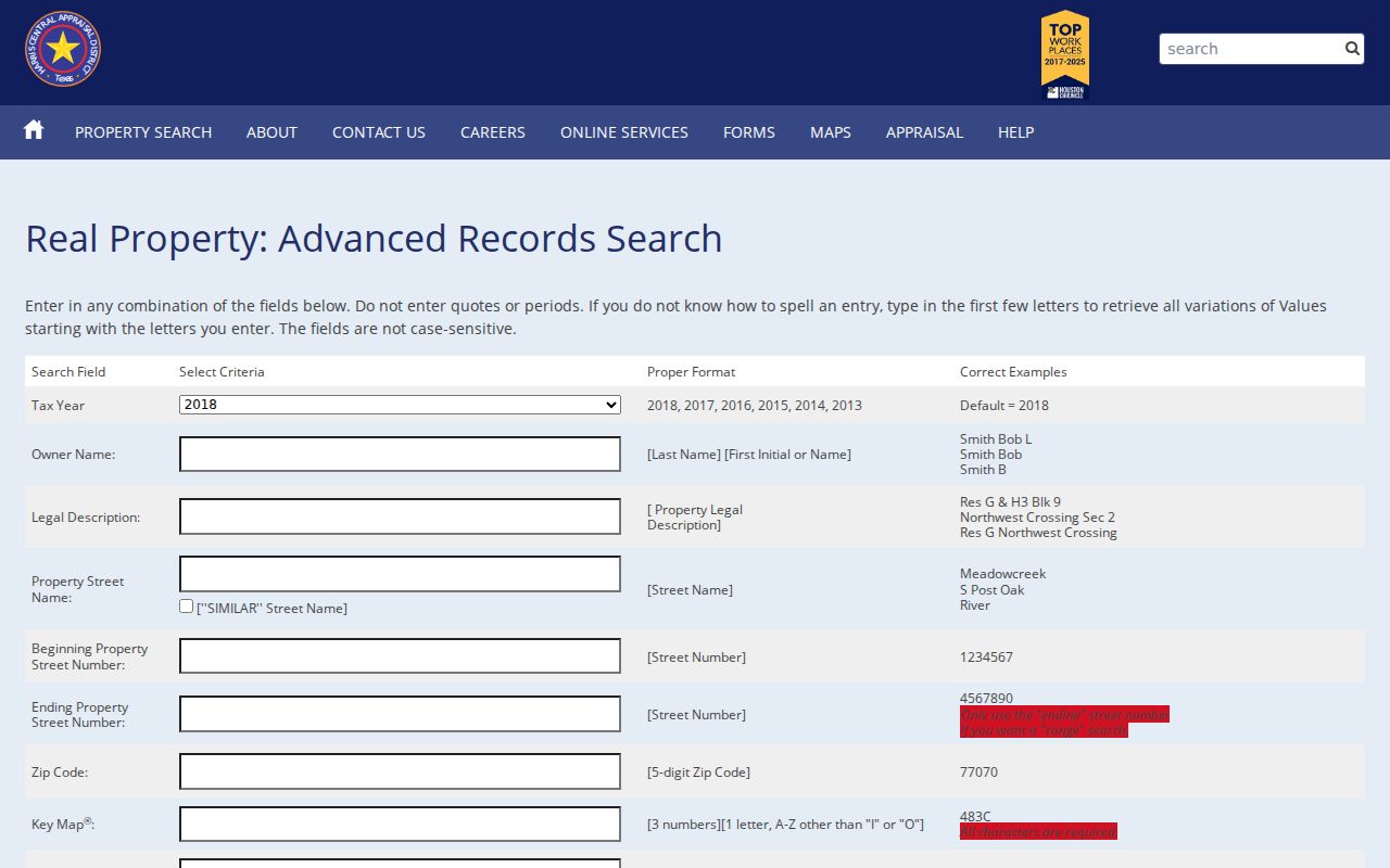
A ZIP filter works best with a property street or legal-description field, especially where postal city and appraisal situs labels do not match word for word.
| HCAD field | Control type | Required | ZIP-search use |
|---|---|---|---|
| Tax Year | Dropdown | Not stated | Keep the selected year with any appraisal result. |
| ZIP Code | Text | Not stated | Filters matching appraisal accounts by postal area. |
| Property Street Name | Text | Not stated | Pairs a postal filter with a road name. |
| Beginning and ending number | Text pair | Not stated | Narrows a street segment within a ZIP. |
| Legal Description | Text | Not stated | Bridges a parcel to County Clerk recorded instruments. |
| Key Map or Map Facet | Text | Not stated | Retains a stable map reference when street text varies. |
Channelview ZIP Results Need an Address Check
HCAD Quick Search complements the advanced ZIP filter. It accepts an account number, street address, range address, or owner name. Its help notes that a site address can have a zero number, a different street spelling, a separate mailing address, or no mapped account. For that reason, a ZIP match should be checked against the actual property or situs address and the legal description. HCAD’s zero-numbered Wallisville Road example is a useful local reminder that a valid indexed site number does not always resemble an ordinary road number.
The HCAD Quick Search shows the address, range-address, account, and owner pathways used after a ZIP code has narrowed the field.
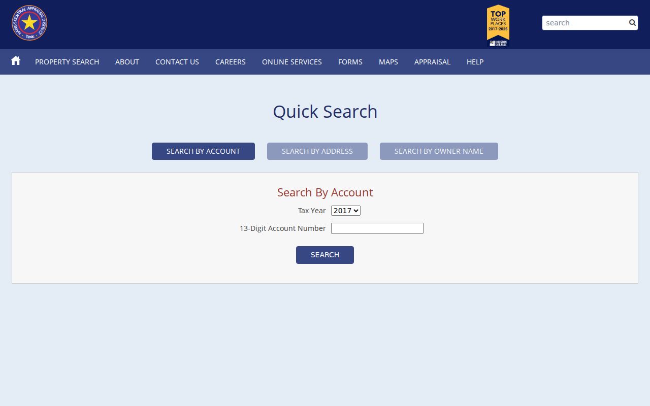
Save the account, property address, owner or mailing field, legal description, map facet, and key map as separate values. They answer different questions and should not be collapsed into one mailing label.
HCAD’s public download list covers 2005 through 2026 at inspection, but only 2009-current is the strongest online appraisal period. For 1895-1997 appraisal material, use Harris County Archives; for 1998-2008, use the HCAD contact or archive route. A missing online record may reflect that handoff rather than a missing property history.
Narrow a Channelview ZIP to a Parcel
ZIP-level searching gains reliability when it moves from a delivery label to a particular parcel. Begin by validating the address with USPS. Use the resulting ZIP and property street in HCAD Advanced Search, or use HCAD Quick Search when the full address is known. Then compare the HCAD situs, legal description, and account with the parcel viewer. If the goal is a recorded transaction, take the legal description to the County Clerk rather than expecting the deed index to browse by ZIP.
- Confirm the exact postal label with USPS, preserving the entered address and the validated ZIP separately.
- Run the ZIP with a street name or number in HCAD Advanced Search, or use the full address in Quick Search.
- Record the 13-digit HCAD account, situs, legal description, key map, and map facet from the best parcel match.
- Use the HCAD Parcel Viewer to inspect approximate geometry, then select the parcel record rather than relying on a broad map area.
- Search the County Clerk index by legal description, grantor or grantee, date, and instrument fields if the question concerns a recorded transaction.
The Harris County voter search is an individual current or pending-status tool, not a public ZIP-wide roster. State voter-file requests are a separate regulated channel through the Texas SOS voter-data form. Once a ZIP has narrowed the address, the Channelview street directory provides the address-by-address parcel and deed workflow.
Note: A ZIP-wide HCAD result identifies matching accounts, while a parcel-level result adds the legal and map references needed to check a specific property.
Channelview ZIP Codes Are Not City Limits
Channelview is an unincorporated census-designated place in east Harris County. It has no incorporated municipal boundary or city clerk that can serve as a universal local records custodian. The Channelview Community Planning Study uses Wallisville Road, the old San Jacinto River, Beltway 8, and the Houston Ship Channel or Carpenter’s Bayou as a planning-study geography. Those edges are useful context, but they are not a ZIP map and not a legal city line.
ZIP 77049 demonstrates the mismatch directly: the Houston map can show a city-limit line and a Channelview label within one ZIP. Postal delivery does not decide HCAD account geography, County Clerk custody, census geography, or county service coverage. Use the Harris County OCE civil permits route for county development context, and retain the source’s own geography label in notes.
- ZIP code
- A postal delivery code assigned by USPS. It is not a municipal boundary or parcel identifier.
- ZIP+4
- An added four-digit delivery segment used for finer mail sorting. It does not change the base ZIP’s legal geography.
- PO-box ZIP
- A ZIP used for post-office boxes. No such Channelview-serving ZIP was located in the official sources reviewed.
- Unique ZIP
- A ZIP used for one qualifying organization or institution. No Channelview example was located in the official sources reviewed.
- Carrier route
- A mail-delivery sequence within postal operations. It is not a public roster or a proof of residence.
Channelview ZIP Context Is Community Scale
The 2020 Census count for Channelview is 45,688, and Census QuickFacts reports a 72.2% owner-occupied share for 2020-2024. These are community-level measures, not counts for a ZIP, an address, or a household. They help explain why property, county, and postal systems overlap so often in this growing east Harris County area, but they should never be used to infer the status of a person attached to a search result.
The Census QuickFacts record for Channelview CDP is the source for those community measures. The 77530 post-office anchor and 77049 property and library examples are better tools for the postal question itself. Keep each evidence type in its own lane: census for community context, USPS for delivery, HCAD for parcels, and county custodians for their record series.
Limits of a Channelview ZIP Search
A ZIP code search can filter an appraisal query and help validate an address, but it cannot prove every current connection to that address. County Clerk instruments are indexed by parties, dates, legal descriptions, and instrument data, not a simple ZIP browser. The HCAD Parcel Viewer supports address or place searching and map clicks, but it does not offer the same ZIP-wide query controls as Advanced Search. OCE records can use an address or project number, yet a complete public historical permit-field list was not located.
When an online channel does not hold the relevant series, a Texas Public Information Act request can seek an existing log, image series, export, or retention schedule from the custodian. Under Texas Government Code Chapter 552, identify the record and date range rather than asking an agency to compile a new list based on a ZIP.